How Satellites Are Helping Your Local Farm Know Exactly What Your Soil Needs
Picture this: satellites orbiting hundreds of miles above your small organic farm are tracking soil moisture levels, monitoring crop health, and predicting yields with stunning accuracy. What once seemed like technology reserved for industrial agriculture giants is now becoming accessible to family farms and CSA operations, transforming how we grow food sustainably.
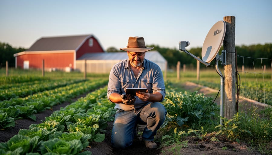
Satellite earth observation uses specialized cameras and sensors mounted on orbiting spacecraft to capture detailed images and data about our planet’s surface. For farmers, this means gaining insights that were previously impossible without expensive equipment or time-consuming field walks. These eye-in-the-sky tools can detect plant stress before it’s visible to the human eye, identify areas needing irrigation, and even estimate harvest timing down to the week.
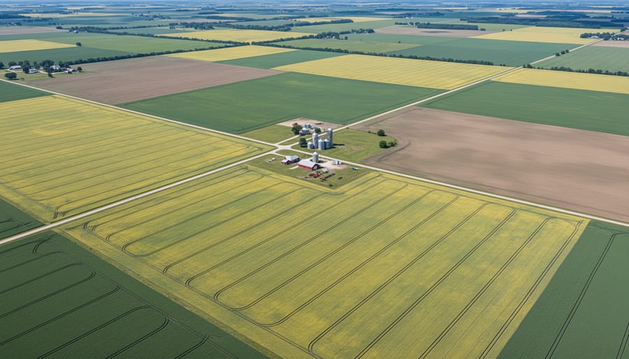
The beauty of this technology lies in its democratic potential. Free and low-cost satellite data from programs like NASA’s Landsat and the European Space Agency’s Copernicus are leveling the playing field. Small-scale organic farmers are using these resources to make smarter decisions about water management, identify pest pressure zones early, and provide transparency to CSA members about farm practices and progress throughout the growing season.
Think of satellite observation as having a tireless farm assistant who never sleeps, constantly monitoring your fields and alerting you to changes. It complements traditional farming wisdom rather than replacing it, combining generations of knowledge with cutting-edge insights. Whether you’re managing five acres or fifty, understanding how to access and interpret this data can reduce input costs, minimize environmental impact, and increase productivity without compromising your organic principles.
This technology isn’t science fiction anymore. It’s practical, affordable, and increasingly essential for farmers committed to sustainable agriculture in our changing climate.
What Satellite Earth Observation Actually Means for Small Farms
From Space to Your CSA Box: The Journey of Farm Data
You might imagine satellite technology as something reserved for big commercial farms with deep pockets, but here’s the exciting news: the journey from space to your CSA box is more accessible than ever, and much of it is completely free.
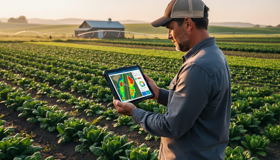
Here’s how it works. Satellites like those in the European Space Agency’s Copernicus program and NASA’s Landsat series continuously photograph Earth, capturing detailed images every few days. These images reveal invisible patterns—like which areas of your field have stressed plants or uneven moisture—using special sensors that detect light beyond what human eyes can see.
The best part? You don’t need fancy equipment to access this information. Platforms like Google Earth Engine, Sentinel Hub, and the USDA’s CropScape offer user-friendly interfaces where farmers can simply draw their field boundaries and receive customized data. Many of these tools work right from your smartphone or laptop.
Take Sarah Chen, who runs a 15-acre CSA in Vermont. She discovered FarmLens, a free tool that sends her weekly field health reports based on satellite imagery. “I was skeptical at first,” she admits, “but now I check it like I check the weather. Last season, it spotted an irrigation issue I would have missed for weeks.”
Getting started is straightforward: create a free account on platforms like Planet’s Education and Research Program or NASA’s Earthdata, enter your farm coordinates, and explore pre-made agricultural monitoring tools. Most platforms include tutorials designed specifically for small-scale farmers, making space-age technology genuinely accessible to everyone growing food.
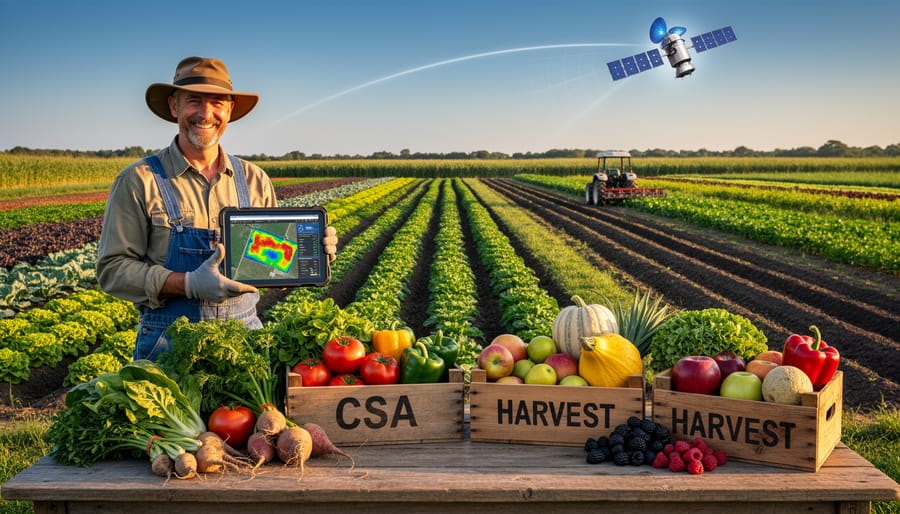
Real Ways CSA Farms Are Using Satellite Data Right Now
Spotting Problem Areas Before Your Eyes Can
Imagine having a crystal ball that reveals hidden troubles in your fields weeks before they become visible to the naked eye. That’s exactly what satellite imagery offers organic farmers today. These orbiting cameras capture data beyond what we can see, measuring light reflection patterns that indicate plant health.
When crops face stress from drought, disease, or nutrient deficiencies, their leaves reflect light differently long before they show visible symptoms like yellowing or wilting. Satellites detect these subtle changes through specialized sensors, creating detailed maps that highlight problem zones in your fields. Similar to aerial technology, this bird’s-eye perspective helps farmers spot issues early.
For organic growers, this early warning system is invaluable. Instead of treating entire fields with organic inputs, you can target specific areas where plants need help. Notice a patch showing nitrogen deficiency? Apply compost or organic fertilizer precisely where needed. Spot potential pest pressure building in one corner? Introduce beneficial insects or apply natural deterrents before the problem spreads.
Take Sarah Chen, an organic vegetable farmer in Ontario, who credits satellite monitoring with saving her tomato crop last season. The imagery revealed stress patterns suggesting fungal issues two weeks before visible symptoms appeared, giving her time to adjust irrigation and apply organic fungicides preventatively. “It’s like having a health monitor for my entire farm,” she explains, noting how this technology helps stretch her organic input budget while protecting yields.
Watering Smarter, Not Harder
Water is one of farming’s most precious resources, and satellite technology is revolutionizing how CSA farms manage every drop. Instead of watering entire fields uniformly, satellite imagery reveals exactly which areas need moisture and which don’t. Infrared sensors detect subtle plant stress before it’s visible to the naked eye, allowing farmers to intervene early and target irrigation precisely where needed.
This precision approach saves thousands of gallons of water each season while ensuring crops stay healthy. When combined with real-time monitoring systems, farmers can create customized watering schedules based on actual soil moisture levels and crop needs rather than guesswork or fixed routines.
During drought seasons, this technology becomes invaluable. Sarah Chen, who runs Green Valley Farm in Ontario, credits satellite-guided irrigation with reducing her water usage by 35 percent while improving crop yields. “I can see exactly where my tomatoes are thirsty versus where they’re fine,” she explains. “It’s like having x-ray vision for soil moisture.”
The cost savings extend beyond water bills. Targeted irrigation reduces energy costs from running pumps, minimizes fertilizer runoff by avoiding overwatering, and prevents crop diseases that thrive in overly wet conditions. For small CSA operations working with tight margins, these efficiencies make sustainable farming more economically viable while protecting our most vital natural resource.
Success Story: How One CSA Increased Yields by Watching From Above
When Green Valley Farm in upstate New York started their CSA five years ago, farmer Maria Chen relied on traditional methods and intuition to manage her 15-acre organic operation. While her produce was beautiful, she struggled with uneven crop performance across different field sections and couldn’t quite pinpoint why some areas consistently underperformed.
Everything changed when Maria discovered free satellite imagery through the European Space Agency’s Copernicus program. By downloading images every few weeks during the growing season, she could view her entire farm through specialized filters that revealed plant health invisible to the naked eye.
The results were eye-opening. Satellite data showed that a section she’d assumed was thriving actually had struggling crops compared to the rest of the field. This prompted soil testing that revealed a drainage issue she’d never noticed from ground level. After addressing the problem with contour planting and cover crops, that troublesome area became one of her most productive.
Maria also began using historical satellite images to track how different crop rotations affected soil health over time. She discovered that certain combinations left fields in better condition than others, allowing her to optimize her three-year rotation plan. The data helped her explain these improvements to CSA members during farm tours, and many appreciated seeing the high-tech approach behind their organic vegetables.
Three years after adopting satellite monitoring, Green Valley Farm increased overall yields by 22 percent while maintaining organic certification. Member retention jumped to 85 percent, partly because Maria could now predict and prevent problems before they affected harvest shares. Best of all, she spends less time guessing and more time growing.
What This Means for You as a CSA Member
When choosing a CSA farm, you’re investing in more than just fresh vegetables. You’re supporting a farming approach that increasingly harnesses cutting-edge technology to deliver the quality and sustainability you value. Here’s how satellite earth observation directly benefits your CSA experience.
First and foremost, you’ll notice the difference in your produce box. Satellite-informed farming allows your farmers to monitor crop health with incredible precision, catching potential issues before they affect quality. This means you receive vegetables at their nutritional peak, harvested at exactly the right moment. Your tomatoes taste better, your greens stay fresher longer, and your root vegetables have that perfect texture because farmers can track growing conditions down to specific field sections.
The environmental benefits align perfectly with why many people choose CSA memberships. Satellite data helps farmers apply water and nutrients only where needed, dramatically reducing waste and runoff. This precision approach means your food is grown with a lighter environmental footprint, protecting local waterways and soil health for future seasons. One member from a satellite-using farm in Ontario shared how her farmer explained they reduced water usage by 30 percent while actually improving yields, something that made her membership feel even more impactful.
You’ll also likely enjoy greater variety throughout the season. Better crop monitoring means farmers can confidently experiment with diverse plantings, knowing they can track how different varieties perform in various field locations. This translates to more interesting weekly boxes and exposure to unique heirloom varieties that might have been too risky without precise monitoring.
Perhaps most importantly, this technology helps small organic farms remain viable and competitive. By improving efficiency and reducing losses, satellite observation supports the long-term sustainability of the farms you depend on. Your CSA isn’t just surviving; it’s thriving with tools that make sustainable farming both environmentally sound and economically practical, ensuring fresh, local food remains accessible for years to come.
Getting Started: Resources for Farmers and Farm-Curious Folks
Free Tools Your Local Farm Can Use Today
Ready to explore satellite technology for your farm without breaking the bank? Several free platforms make precision agriculture tools accessible to small-scale growers today.
LandViewer offers beginner-friendly access to satellite imagery from multiple sources. You can view your fields in different light spectrums to spot crop health issues before they’re visible to the naked eye. The platform’s intuitive interface makes it easy to compare images from different dates, helping you track seasonal changes.
Sentinel Hub Playground provides free access to European Space Agency data updated every few days. It’s perfect for monitoring soil moisture, vegetation health, and even frost risk. The visual tools help you understand what satellites see without needing a science degree.
NASA’s LANCE system delivers near real-time Earth observation data. While it has a learning curve, the wealth of information about weather patterns, temperature variations, and environmental conditions proves invaluable for planning planting and harvest schedules.
FarmLens brings satellite technology directly to your smartphone. This mobile app translates complex satellite data into simple crop health reports, making it ideal for farmers just starting their precision agriculture journey.
Google Earth Engine, though slightly more technical, offers incredible power for those willing to invest learning time. Many farmers use it to analyze historical land use patterns and make informed decisions about crop rotation and field management.
Questions to Ask Your CSA Farmer
Curious about whether your CSA farm uses satellite technology? Great! Most farmers love talking about their practices. Start by asking if they use any remote sensing or satellite data to monitor crop health or soil conditions. You might be surprised to learn they’re already using free tools from NASA or the European Space Agency to optimize watering schedules or detect plant stress early.
Ask how technology helps reduce water usage or minimize inputs on the farm. This shows you value their sustainable practices while learning about precision agriculture firsthand. If they’re not currently using these tools, you could share what you’ve learned—many farmers appreciate when members bring new resources to their attention.
Consider questions like: “How do you decide when to irrigate different fields?” or “Do you use any mapping tools to track soil health across seasons?” These conversations build community and deepen your connection to where your food comes from. Remember, technology adoption looks different for every farm. Some use advanced satellite imagery, while others rely on time-tested observation skills. Both approaches deserve respect and curiosity. Your genuine interest might even inspire farmers to explore new sustainable solutions that benefit everyone.
The marriage of satellite earth observation technology with traditional organic farming practices represents one of the most exciting developments in sustainable agriculture today. It’s a partnership that honors the wisdom passed down through generations while embracing tools that help us farm more intelligently and responsibly.
What’s truly remarkable is that satellite technology doesn’t diminish the farmer’s role. Instead, it amplifies their expertise, providing another layer of insight to inform the decisions they’ve always made with careful observation and deep knowledge of their land. When a farmer combines their understanding of soil texture, crop behavior, and seasonal patterns with precise satellite data, they create a powerful synergy that benefits everyone in the food chain.
For CSA members, this technology translates into tangible improvements: healthier, more nutrient-dense produce, reduced environmental impact, and the assurance that your farm is operating at the cutting edge of sustainable practices. These aren’t industrial-scale operations losing touch with the land. These are dedicated farmers using every available tool to grow food that’s better for you, better for the soil, and better for future generations.
The farmers leading this charge demonstrate that innovation and organic principles aren’t opposing forces. They work hand in hand. Whether it’s detecting water stress before plants show visible signs, identifying nutrient deficiencies early, or monitoring soil health across entire fields, satellite observation helps organic farmers be more precise, more efficient, and more sustainable.
As you explore CSA options in your community, consider supporting farms that embrace these innovations. Ask questions about how they use technology to enhance their organic practices. By choosing farms that blend tradition with innovation, you’re investing in a food system that’s resilient, sustainable, and ready for whatever challenges tomorrow brings.